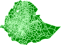
- Thumbnail

- Resource ID
- 6ece5eec-86d2-11ea-975d-000c2931b24c
- Title
- Ethiopian Woreda Boundary
- Date
- April 25, 2020, 3:54 a.m., Publication
- Abstract
- Projected Coordinate System: WGS 84 / UTM zone 37N
Projection: Transverse_Mercatortract provided.
source: CSA
- Edition
- --
- Owner
- admin
- Point of Contact
- Ayele
- tsegayeayele840@gmail.com
- Purpose
- For COVID_19 analysis purpose
- Maintenance Frequency
- asNeeded
- Type
- vector
- Restrictions
- None
- License
- Not Specified
- Language
- eng
- Temporal Extent
- Start
- --
- End
- --
- Supplemental Information
- No information provided
- Data Quality
- --
- Extent
-
- long min: -162392.080951240000000
- long max: 1491073.385084390000000
- lat min: 375692.466013907000000
- lat max: 1641505.331212160000000
- Spatial Reference System Identifier
- EPSG:32637
- Keywords
- no keywords
- Category
- Boundaries
- Regions
-
Ethiopia
